Leicester City Centre
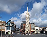
Human settlement in EnglandLeicester City Centre is Leicester's historical commercial, cultural and transport hub and is home to its central business district. Its inner core is roughly delineated by the A594, Leicester's inner ring road, although the various central campuses of the University of Leicester, De Montfort University and Leicester College are adjacent to the inner ring road and could be considered to be a continuation of the City centre. In a similar way, the Leicester Royal Infirmary precinct, New Walk business district (Southfields), the Welford Road Stadium of Leicester Tigers’ RUFC and the King Power Stadium of Leicester City to the south, and the Golden Mile to the north could also be deemed to be extensions to the central core.
Read article


Top Questions
AI generatedMore questions
Nearby Places
Leicester
City and unitary authority in England

Highcross Leicester
Shopping mall in Leicester, England
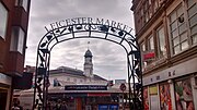
Leicester Market

Haymarket Memorial Clock Tower
Grade II listed clock tower in Leicester, UK

Haymarket Shopping Centre
Shopping centre in Leicester, England

Leicester Corn Exchange
Municipal building in Leicester, England
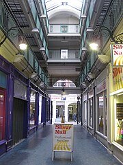
Silver Arcade

Statue of Alice Hawkins
Statue in Leicester, England