Lakelands Trail State Park
State park in Michigan, United StatesLakelands Trail State Park, officially the Mike Levine Lakelands Trail State Park since January 20, 2017, is a state park in Michigan that runs east–west from southwest of Munith to Hamburg Township, Michigan. It is a multi-use trail converted from abandoned railroad corridors. According to the Michigan DNR web site, the north side of the trail is for hiking and biking, and the south side is for horseback riding. Based on the latest published DNR map the trail is 31.9 miles (51.3 km) long with the surface from Hawkins Rd. southwest of Munith to west of Pinckney composed of sections of crushed limestone, slag and sand, or unimproved. 10 miles (16 km) are paved in Hamburg Township from the first intersection with M-36 west of Pinckney to end of the park east of the Hamburg Rd. trailhead. A paved section of trail also extends from the edge of the park east of Hamburg Rd. to the west side of Whitmore Lake Rd., just south of its intersection with 9 Mile Rd in Green Oak Township.
Read article
.jpg)


Top Questions
AI generatedMore questions
Nearby Places

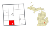
Pinckney, Michigan
Village in Michigan, United States
Putnam Township, Michigan
Civil township in Michigan, United States

Unadilla Township, Michigan
Civil township in Michigan, United States

Hell, Michigan
Unincorporated community in Michigan, United States

Gregory, Michigan
Unincorporated community in Michigan, United States

Pinckney State Recreation Area
Michigan state recreation area
Pinckney High School
School
Richmond Field
Airport