La Paz, State of Mexico
Municipality in State of Mexico, MexicoLa Paz is a municipality in the State of Mexico, Mexico, with its municipal seat in the town of Los Reyes Acaquilpan. It is located on the dividing line between Mexico State and the eastern edge of the Federal District and is part of the Greater Mexico City area. The area was part of a region called "Atlicpac" which in Náhuatl means 'above or at the edge of water.' The current city's/municipality's glyph symbolizes water.
Read article


Top Questions
AI generatedMore questions
Nearby Places

Estadio Neza 86
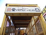
Peñón Viejo metro station
Mexico City metro station

Acatitla metro station
Mexico City metro station

Santa Marta metro station
Mexico City metro station

Los Reyes metro station
Mexico City metro station

Chimalhuacán
City & Municipality in State of Mexico ----, Mexico
XEL-AM
Radio station in Mexico City

La Paz metro station (State of Mexico)
Mexico City metro station