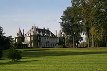
La Hulpe
Municipality in French Community, BelgiumLa Hulpe is a municipality of Wallonia in the Belgian province of Walloon Brabant, 20 km south-east of the centre of Brussels, but only about 3 km from the edge of the Brussels-Capital Region. On January 1, 2007, La Hulpe had a total population of 7,309. The total area is 15.60 km2, including 3 km2 of the Sonian Forest; this gives a population density of 463 inhabitants per km2.
Read article
Top Questions
AI generatedMore questions
Nearby Places

SWIFT
Financial telecommunication network

Hoeilaart
Municipality in Flemish Community, Belgium

Rixensart
Municipality in French Community, Belgium

Ohain, Belgium

Lake Genval
Freshwater artificial lake in Belgium

Genval railway station
Railway station in Walloon Brabant, Belgium

Solvay Castle
Château in Walloon Brabant, Belgium.

European School of Bruxelles-Argenteuil
School in Waterloo, Belgium


