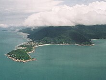
Ko Pha-ngan
District in Surat Thani, ThailandKo Pha-ngan is an island in the Gulf of Thailand in Surat Thani Province of southern Thailand. Ko Pha-ngan has two sister islands: the larger Ko Samui to the south and the smaller Ko Tao to the north.Estimated perimeter: 40 km (25 mi) From mainland: about 55 km (34 mi) From Ko Samui: about 15 km (9.3 mi) From Ko Tao: about 35 km (22 mi) Main town: Thong Sala Highest Point: Khao Ra, 635 m (2,083 ft)
Read article
Top Questions
AI generatedMore questions


