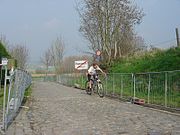
Kluisbergen
Municipality in the Belgian province of East FlandersKluisbergen is a municipality located in the Belgian province of East Flanders, along the Scheldt river. The municipality comprises the towns of Berchem, Kwaremont, Ruien and Zulzeke which fused in 1971. In 2021, Kluisbergen had a total population of 6,682. The total area is 30.38 km². The town of Ruien is the largest and has some outdoor facilities. Kluisbergen is also home to the "Kluisbos", a forest which has 2 ancient standing stones, dating back to Roman times.
Read article
Top Questions
AI generatedMore questions


