Kittanning Gap
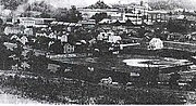
Kittanning Gap, one of the gaps of the Allegheny, is a now a relatively unimportant wooded ravine along the ascent of the Allegheny Ridge (also called the 'Allegheny Front' or 'Allegheny escarpment') in central Pennsylvania in the United States. The gap was one of several optional paths of the Kittanning Path Amerindian trail turned into an emigrant route over the Alleghenies in the day of animal powered technology. The option up the gap was likely the 'better choice' of an ascending route for ox cart and wagon encumbered white settlers pouring west across the Alleghenies escarpment.
Read article


Top Questions
AI generatedMore questions
Nearby Places

Horseshoe Curve (Pennsylvania)
Rail curve in Altoona, Pennsylvania
Veterans Memorial Field
Columbia Park (Altoona)
Baseball field in Altoona, Pennsylvania, US

Broad Avenue Historic District
Historic district in Pennsylvania, United States

Knickerbocker Historic District
Historic district in Pennsylvania, United States

Kittanning Run
Eldorado, Pennsylvania
Census-designated place in Pennsylvania, United States
Mill Run, Blair County, Pennsylvania
Census-designated place in Pennsylvania, United States