Kingsthorpe
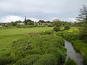
Suburb in Northampton, EnglandKingsthorpe is a suburb and civil parish of Northampton, England. It is situated to the north of Northampton town centre and is served by the A508 and A5199 roads which join at Kingsthorpe's centre. The 2011 Census recorded the population of the district council ward as 4,477.
Read article

.svg)


.jpg)

Top Questions
AI generatedMore questions
Nearby Places
White Hills, Northamptonshire

University of Northampton
Public university in Northampton, England
Kingsthorpe College
Academy in Northampton, Northamptonshire, England

A508 road
Road in Leicestershire and Northants
Northampton Spencer F.C.
Association football club in England
Radlands (skatepark)
Malcolm Arnold Academy
Academy in Northampton, Northamptonshire, England
Kingsthorpe Meadow