Kilburn Lane
Street in London, EnglandKilburn Lane is a street in Northwest London which runs through North Kensington, London and Kilburn, London. Its route marks the boundary between the City of Westminster and the London Borough of Brent. To the east it continues into South Kilburn as Carlton Vale. At the western end the street curves southwards until it meets Harrow Road, becoming Ladbroke Grove and continuing across the Grand Union Canal.
Read article


Top Questions
AI generatedMore questions
Nearby Places

Kilburn, London
Area of London, England

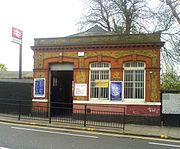
Queen's Park station (England)
London Underground and London Overground station

Kensal Rise railway station
London Overground station

Queen's Park, London
Suburb of London
Islamia Primary School
Islamic primary school in London, England, United Kingdom
Brondesbury Park
Suburb of London, England

The Flora
Pub in Kensal Green, London
Kilburn Grammar School
Former grammar school in London, England