Keaīwa Heiau State Recreation Area
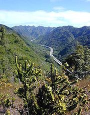
Ruins of a temple at Aiea Heights on Oahu, Hawaii, United StatesKeaīwa Heiau State Recreation Area is the ruins of a temple at the summit of a hill and neighborhood called ʻAiea Heights on Oʻahu, Hawaiʻi. The recreation area includes camping facilities and a 4.8-mile (7.7 km) trail. It also offers clear views of Pearl Harbor. The high point of Puu Uau is about halfway down the trail, where native ohia lehua and koa trees may be viewed. The remains of a military plane that crashed in 1944 can also be seen along the trail. The hike is not particularly difficult, however it does include one quite steep switchback stretch and can be extremely muddy if it has just rained. Allow for around 2.5 hours of easy strolling. A possible translation of Keaʻiwa would be mysterious, incomprehensible. It is believed that this name was given in reference to the healing powers of the plants that no one could really explain. In addition, Keaiwa Heiau may have also been known as a "Heiau Hoʻola," or the healing or life-giving heiau according to native Hawaiian scholar Mary Kawena Pukui.
Read article


Top Questions
AI generatedMore questions
Nearby Places

Aiea, Hawaii
Census-designated place in Hawaii, United States
Halawa, Hawaii
Census-designated place in Hawaii, United States

Camp H. M. Smith
US Marine Corps base in Oahu, Hawaii

Moanalua
Neighborhood of Honolulu, Hawaii, United States
Pali Momi Medical Center
Hospital in Hawaii, United States
Halawa Correctional Facility
Christian Academy (Honolulu)
School in the United States

Red Hill water crisis
Environmental disaster in Honolulu, Hawaiʻi