Iwo Jima
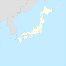
One of the Japanese Volcano IslandsIwo Jima, officially romanized and pronounced Iōtō, is one of the Japanese Volcano Islands, which lie south of the Bonin Islands and together with them make up the Ogasawara Archipelago. Together with the Izu Islands, they make up Japan's Nanpō Islands. Although 1,200 km (750 mi) south of Tokyo on Honshu, Iwo Jima is administered as part of the Ogasawara Subprefecture of the Tokyo Metropolitan Government.
Read article
Top Questions
AI generatedMore questions
Nearby Places

Battle of Iwo Jima
Major World War II battle in the Pacific Theater

Volcano Islands
Group of Japanese-governed islands in Micronesia

Mount Suribachi
Cinder cone on the island of Iwo Jima, Japan

Central Field (Iwo Jima)
WW2 airfield in Iwo Jima, Japan
Iōjima, Tokyo
Former municipality in Kantō region, Japan
Japanese minesweeper Showa Maru No. 7
Japanese auxiliary minesweeper of WW II
Japanese minesweeper Keinan Maru

Naval Base Iwo Jima
US Navy Base on Japanese Volcano Iwo Jima


