Iturup
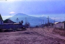
Largest of the Kuril IslandsIturup, also historically known by other names, is an island in the Kuril Archipelago separating the Sea of Okhotsk from the North Pacific Ocean. The town of Kurilsk, administrative center of Kurilsky District, is located roughly midway along its western shore. Iturup is the largest and northernmost of the southern Kurils, ownership of which is disputed between Japan and Russia. It is located between Kunashiri 19 km (12 mi) to its southwest and Urup 37 km (23 mi) to its northeast. The Vries Strait between Iturup and Urup forms the Miyabe Line dividing the predominant plants of the Kurils.
Read article
Top Questions
AI generatedMore questions


