Ingen, Netherlands
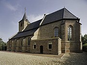
Village in Gelderland, NetherlandsIngen is a village in the Dutch province of Gelderland. It is a part of the municipality of Buren, and lies about 9 km south-west of Veenendaal. Before 1999 the town was part of the municipality of Lienden from 1818 till 1999. The houses are widely spread into a bowl form. The houses link to the townships De Ganzert and Eck en Wiel in the West.
Read article


Top Questions
AI generatedMore questions
Nearby Places
Eck en Wiel
Village in Gelderland, Netherlands
Essebroek
Hamlet in Gelderland, Netherlands

Ganzert
Hamlet in Gelderland, Netherlands

Hoog Kana
Hamlet in Gelderland, Netherlands
Klinkenberg, Gelderland
Hamlet in Gelderland, Netherlands

Luchtenburg
Hamlet in Gelderland, Netherlands

Ommeren
Village in Gelderland, Netherlands

Zevenmorgen
Hamlet in Gelderland, Netherlands