Indo-Gangetic Plain
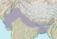
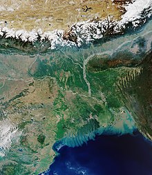
Geographical plain in South AsiaThe Indo-Gangetic Plain, also known as the Northern Plain or North Indian River Plain, is a fertile plain spanning 700,000 km2 (270,000 sq mi) across the northern and north-eastern part of the Indian subcontinent. It encompasses northern and eastern India, eastern Pakistan, southern Nepal, and almost all of Bangladesh. It is named after the two major river systems that drain the region–Indus and Ganges.
Read article
Top Questions
AI generatedMore questions
Nearby Places

Kannauj Lok Sabha constituency
Constituency of the Indian parliament in Uttar Pradesh
Araul
Town in Uttar Pradesh, India
Gangupur
Village in Uttar Pradesh, India

Kannauj Assembly constituency
Constituency of the Uttar Pradesh legislative assembly in India
Gajana (Bilhaur)
Village in Uttar Pradesh, India
Halpura
Village in Uttar Pradesh, India
Kamalpur, Karhal
Village in Uttar Pradesh, India


