Hurstpierpoint
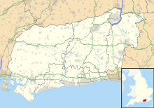
Village and parish in West Sussex, EnglandHurstpierpoint is a village in the Mid Sussex district, in the county of West Sussex, England, 4 miles (6.4 km) southwest of Burgess Hill, and 1.5 miles (2.4 km) west of Hassocks railway station. It sits in the civil parish of Hurstpierpoint and Sayers Common which has an area of 2029.88 ha and a population of 7,112.
Read article
Top Questions
AI generatedMore questions
Nearby Places

Hurstpierpoint College
Public school in Hurstpierpoint, West Sussex, England

Albourne
Village and civil parish in West Sussex, England

Sayers Common
Village in West Sussex, England

Danny House
Grade I listed Elizabethan red brick mansion in West Sussex, England
Hurst Wickham
Village in West Sussex, England

Hurstpierpoint and Sayers Common
Civil parish in West Sussex, England

Hurstpierpoint & Bolney (electoral division)
Electoral division of West Sussex, UK

Mansion House, Hurstpierpoint
Human settlement in England


