Humewood–Cedarvale
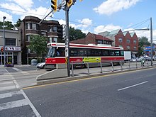
Neighbourhood in Toronto, Ontario, CanadaHumewood–Cedarvale is an area of Toronto, Ontario, Canada, consisting of Humewood in the south, divided by Vaughan Road and Cedarvale Ravine. The neighbourhood is bordered by Bathurst Street on the east, Eglinton Avenue to the north, Arlington Avenue to the west, and St. Clair Avenue to the south. Humewood has also been known as "the Woods" because of its many streets that have names ending with "-wood", including Wychwood, Humewood, Cherrywood, Valewood, Maplewood, Wellwood, Kenwood, and Pinewood. The neighbourhood's main commercial areas are along St. Clair Ave. W., referred to as Hillcrest Village and along Eglinton Ave. W..
Read article
Top Questions
AI generatedMore questions
Nearby Places

St. Michael's College School
Catholic private high school in Forest Hill, Toronto, Ontario, Canada

St. Michael's College School Arena
Hockey arena in Toronto, ON, CA

Holy Blossom Temple
Reform synagogue in Toronto, Ontario

Vaughan Road Academy
High school in Toronto, Ontario, Canada (1927–2017)

Cedarvale Park (Toronto)
Park in Toronto, Ontario, Canada

Vaughan Road
Thoroughfare in Toronto, Ontario

Forest Hill station (Toronto)
Future underground LRT station in Toronto, Canada

Beth Tzedec Congregation
Conservative synagogue in Toronto, Ontario, Canada


