Hooton Pagnell
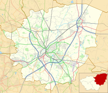
Village and civil parish in South Yorkshire, EnglandHooton Pagnell is a village and civil parish in the Metropolitan Borough of Doncaster in South Yorkshire, England, on the border with West Yorkshire. It lies on the B6422 road, between Brodsworth and South Elmsall and is at an elevation of around 78 metres (256 ft) above sea level. It had a population of 211 at the 2001 Census, reducing slightly to 201 at the 2011 Census. The name of the village derives from Ralph de Paganel, a Norman who was a tenant-in-chief in Yorkshire named in the Domesday Book and an extensive landowner.
Read article
Top Questions
AI generatedMore questions
Nearby Places

Brodsworth Hall
Historic house museum in South Yorkshire, England

Brodsworth
Village and civil parish in South Yorkshire, England

Moorhouse and South Elmsall Halt railway station
Disused railway station in South Yorkshire, England

Frickley railway station
Former railway station in England
Bilham Sand Pits

Frickley
Village in South Yorkshire, England

St Chad's Hostel
Historic hostel in Hooton Pagnell, England

Hooton Pagnell Hall
Historic building in Hooton Pagnell, England


