Holbeck
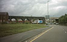
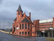
Inner city area of Leeds, West Yorkshire, EnglandHolbeck is an inner city area of Leeds, West Yorkshire, England. It begins on the southern edge of Leeds city centre and mainly lies in the LS11 postcode district. The M1 and M621 motorways used to end/begin in Holbeck. Now the M621 is the only motorway that passes through the area since the end of the M1 moved to Hook Moor near Aberford. Since large parts of Holbeck have been vacated in preparation for the regeneration of the area, the district has in large parts suffered from a population exodus. Holbeck had a population of 5,505 in 2011. The district currently falls within the Beeston and Holbeck ward of Leeds City Council.
Read article
Top Questions
AI generatedMore questions
Nearby Places

Temple Works
Former flax mill and listed building in Holbeck, West Yorkshire, England

Marshall's Mill
Flax spinning mill in Holbeck, West Yorkshire, England

Round Foundry

Midland Mills, Leeds

Holbeck Urban Village
Leeds Whitehall railway station
Former railway station in Leeds, West Yorkshire, England
Brick Man
Sculpture proposed by Antony Gormley in the 1980s

Holbeck TMD
Railway maintenance depot in Holbeck, Leeds


