Henrietta Place
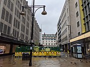
Henrietta Place, originally known as Henrietta Street, is a street in Marylebone in the City of Westminster in central London that runs from Marylebone Lane in the east to Cavendish Square in the west. It is joined on the north side by Welbeck Street and Wimpole Street, and on the south side by Vere Street, Chapel Place, and Old Cavendish Street.
Read article

,_by_John_Wootton.jpg)


.png)
Top Questions
AI generatedMore questions
Nearby Places

Royal College of Nursing
British union for nurses

Royal Society of Medicine
Learned society devoted to medical science in the United Kingdom

St Peter, Vere Street
Church in London, England

Cavendish Square
Public square in the West End of London
Neilson–Terry Guild of Dramatic Art

D H Evans
Former department store in London
Old Cavendish Street

Holles Street