Helena–West Helena, Arkansas
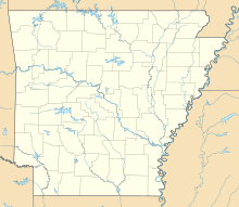
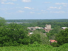
Place in Arkansas, United StatesHelena–West Helena is the county seat of and the largest city within Phillips County, Arkansas, United States. The current city was consolidated, effective January 1, 2006, from the two Arkansas cities of Helena and West Helena. Helena is sited on lowlands between the Mississippi River and the eastern side of Crowley's Ridge. West Helena is located on the western side of Crowley's Ridge, a geographic anomaly in the typically flat Arkansas Delta. The Helena Bridge, one of Arkansas' four Mississippi River bridges, carries U.S. Route 49 across to Mississippi. The combined population of the two cities was 15,012 at the 2000 census and at the 2010 census, the official population was 12,282.
Read article
Top Questions
AI generatedMore questions
Nearby Places

White House (Helena, Arkansas)
Historic house in Arkansas, United States
Helena–West Helena School District
School district in Arkansas, United States

KFFA-FM
Radio station in Helena, Arkansas
Central High School (Helena–West Helena, Arkansas)
School in Helena–West Helena, Arkansas, United States

Faust House (Helena-West Helena, Arkansas)
Historic house in Arkansas, United States

Gemmill-Faust House
Historic house in Arkansas, United States

Myers House (Helena-West Helena, Arkansas)
Historic house in Arkansas, United States

Nelson House (Helena-West Helena, Arkansas)
Historic house in Arkansas, United States


