Hastingwood
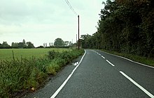
Human settlement in EnglandHastingwood is a hamlet in the North Weald Bassett civil parish of the Epping Forest district of Essex, England. The hamlet is centred on the junction of Hastingwood Road, which runs southwest to the A414 road and the Hastingwood Junction 7 of the M11 motorway, and Mill Street, which runs north to Harlow Common and Potter Street. Nearby settlements include the town of Harlow, North Weald and the hamlet of Foster Street.
Read article
Top Questions
AI generatedMore questions
Nearby Places

A414 road
Major road in England

Brays Grove Community School
Community school in Essex, England
Passmores Academy
Academy in Harlow, Essex, England

Latton Priory
Historic priory in Essex, England

Foster Street
Human settlement in England

Threshers Bush
Human settlement in England

Magdalen Laver
Human settlement in England

Church Langley
Human settlement in England


