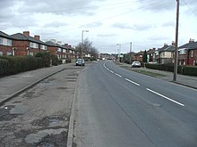
Halton Moor
District of Leeds, West Yorkshire, EnglandHalton Moor is a district of east Leeds, West Yorkshire, England, about three miles east of Leeds city centre close to the A63. It is situated between Killingbeck to the north, Temple Newsam to the south, Osmondthorpe to the west and Halton and Colton to the east.
Read article
Top Questions
AI generatedMore questions
Nearby Places

Halton, Leeds
Human settlement in England

Killingbeck
District of Leeds, West Yorkshire, England

Osmondthorpe
District of east Leeds, West Yorkshire, England
Corpus Christi Catholic College
Academy in Leeds, West Yorkshire, England

Wykebeck
Suburb of Leeds, West Yorkshire, England

St Wilfrid's Church, Halton, Leeds
Murder of Ann Maguire
Murder of schoolteacher in Leeds, United Kingdom

Osmondthorpe railway station
Disused railway station in West Yorkshire, England


