Großer Beerberg
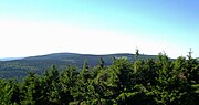
The Großer Beerberg is a mountain, 982.9 m above sea level (NHN), whose summit is the highest point in the Thuringian Forest and the state of Thuringia. It is located between the three villages of Heidersbach, Goldlauter and Gehlberg in the borough of Suhl. The mountain is made of rhyolite that was formed through volcanic processes in the Rotliegendes rock of the Oberhof Formation, about 280 million years ago, and which was uplifted over the surrounding sediments to form a butte.
Read article


Top Questions
AI generatedMore questions