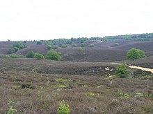
Gelderland
Province of the NetherlandsGelderland, also known as Guelders in English, is a province of the Netherlands, occupying the centre-east of the country. With a total area of 5,136 km2 (1,983 sq mi) of which 176 km2 (68 sq mi) is water, it is the largest province of the Netherlands by land area, and second by total area. Gelderland shares borders with six other provinces and the German state of North Rhine-Westphalia.
Read article
Top Questions
AI generatedMore questions
Nearby Places

Veluwe
Forest-rich ridge of hills in the Netherlands

Deelen
Hamlet in Gelderland, Netherlands

Deelen Air Base
Airport in Deelen

Terlet Airfield
Airport in Arnhem

Woeste Hoeve

Veluwezoom National Park
National park in Gelderland, the Netherlands

Spinnenkop Openluchtmuseum, Arnhem
Dutch windmill

Arnhem post mill (1946)
Dutch windmill


