Garafía
Municipality in Canary Islands, SpainGarafía is a municipality in the island of La Palma, Santa Cruz de Tenerife. Located in the northwest of the island, in the middle of two whims of nature: the ravines of Franceses bordering Barlovento and Izcagua by the South, bordering Punta Gorda. The administrative capital, home to the City Council, is called Santo Domingo; its parish church, Iglesia de Nuestra Señora de La Luz dates back to the 16th century. Garafía has a length of 25.50 km coastline.
Read article


Top Questions
AI generatedMore questions
Nearby Places

Gran Telescopio Canarias
Optical telescope on La Palma, Spain

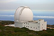
Liverpool Telescope
Telescope at Garafía, La Palma, the Canary Islands, Spain

MAGIC (telescope)
Very-high-energy photon telescope in the Canary Islands, Spain
William Herschel Telescope
Telescope in La Palma, Spain

HEGRA

Roque de los Muchachos Observatory
Observatory

Cueva del Agua, Garafia
Municipality district in Canary Islands, Spain
Galaxy H-Alpha Fabry-Perot System