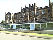
Forth and Clyde Canal
Canal crossing central ScotlandThe Forth and Clyde Canal is a canal opened in 1790, crossing central Scotland; it provided a route for the seagoing vessels of the day between the Firth of Forth and the Firth of Clyde at the narrowest part of the Scottish Lowlands. This allowed navigation from Edinburgh on the east coast to the port of Glasgow on the west coast. The canal is 35 miles (56 km) long and it runs from the River Carron at Grangemouth to the River Clyde at Bowling, and had an important basin at Port Dundas in Glasgow.
Read article
Top Questions
AI generatedMore questions
Nearby Places

Bowling, West Dunbartonshire
Human settlement in Scotland

Bowling railway station
Railway station in West Dunbartonshire, Scotland

Bowling railway station (Lanarkshire and Dunbartonshire Railway)
Disused railway station in Scotland

Dunglass Castle
14th-century ruinous castle in Scotland

Mar Hall
Baronial Mansion in Bishopton, Scotland

Erskine Veterans Charity
Hospital in Erskine, Scotland

Donald's Quay
Human settlement in Scotland
Erskine Castle
Castle in Renfrewshire, Scotland, UK


