Fort Pearson
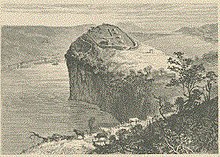
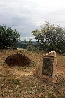
Fort in modern-day South AfricaFort Pearson was a fortification constructed by the British on the Natal side of the border with Zululand in the lead up to the 1879 Anglo-Zulu War. An earthen redoubt on a 300-foot (100 m) high cliff overlooking the Tugela River, the fort and its two external redoubts commanded an important river crossing. The crossing was used by one of the columns of the first invasion of January 1879, that was then besieged at Eshowe in Zululand. The crossing was used again by the Eshowe relief column in March and the second invasion in April. The fort was strengthened in April 1879 and connected to Pietermaritzburg by telegraph by June. The war was won by the British in July but the fort was briefly occupied again by British troops in 1883 during the Third Zulu Civil War.


