Falkirk (council area)
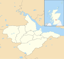
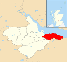
Council area of ScotlandFalkirk is one of 32 unitary authority council areas of Scotland. It was formed on 1 April 1996 by way of the Local Government etc. (Scotland) Act 1994 from the exact boundaries of Falkirk District, one of three parts of the Central region created in 1975, which was abolished at that time. Prior to the 1975 reorganisation, the majority of the council area was part of the historic county of Stirlingshire, and a small part, namely Bo'ness and Blackness, was part of the former county of West Lothian.
Read article
Top Questions
AI generatedMore questions
Nearby Places

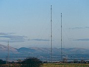
Westerglen transmitting station
Transmitter station in Falkirk, Scotland, UK

Battle of Falkirk Muir
Battle on 17 January 1746 during the Jacobite rising of 1745

Falkirk High railway station
Railway station in Falkirk, Scotland

Woodlands, Falkirk

Falkirk High School
High school in Falkirk, Scotland

Glen Village
Human settlement in Scotland

Shieldhill, Falkirk
Human settlement in Scotland
Bantaskine


