Epirus (region)
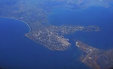
Administrative region of GreeceEpirus is a traditional geographic and modern administrative region in northwestern Greece. It borders the regions of Western Macedonia and Thessaly to the east, West Greece to the south, the Ionian Sea and Ionian Islands to the west and Albania to the north. The region has an area of about 9,200 km2 (3,600 sq mi). It is part of the wider historical region of Epirus, which overlaps modern Albania and Greece but lies mostly within Greek territory.
Read article
Top Questions
AI generatedMore questions
Nearby Places

Dodoni
Municipality in Greece

Dodona
Hellenic oracle

Anatoli
Municipal unit in Greece

Bizani
Municipal unit in Greece
University of Ioannina
Public university in Greece

Greek National Road 17
Trunk road in Greece

Panepirotan National Athletic Center
Sports venue in Ioannina, Greece
Pedini, Greece
Community in Greece


