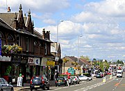
East Renfrewshire
Council area of ScotlandEast Renfrewshire is one of 32 council areas of Scotland. It was formed in 1996, as a successor to the Eastwood district of the Strathclyde region. The northeastern part of the council area is close to Glasgow and many of the council area's northern settlements fall into the Greater Glasgow urban area.
Read article
Top Questions
AI generatedMore questions
Nearby Places

Eastwood, Strathclyde
Former district in Strathclyde, Scotland

Giffnock
Town in East Renfrewshire, Scotland

St Ninian's High School, Giffnock
Secondary school in Giffnock, East Renfrewshire, Scotland

Williamwood railway station
Railway station in East Renfrewshire, Scotland

Giffnock railway station
Railway station in East Renfrewshire, Scotland

Giffnock Newton Mearns Synagogue
Orthodox synagogue in Glasgow, Scotland

A727 road
Road in Scotland

Clarkston, East Renfrewshire
Human settlement in Scotland


