East Frisia
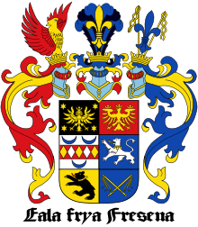
Historic region in Lower Saxony, GermanyEast Frisia or East Friesland is a historic region in modern Lower Saxony, Germany. The modern province is primarily located on the western half of the East Frisian peninsula, to the east of West Frisia and to the west of Landkreis Friesland but is known to have extended much further inland before modern representations of the territory. Administratively, East Frisia consists of the districts Aurich, Leer and Wittmund and the city of Emden. It has a population of approximately 469,000 people and an area of 3,142 square kilometres (1,213 sq mi).
Read article
Top Questions
AI generatedMore questions
Nearby Places

Frisia
Cross-border cultural region in Northwestern Europe

Aurich
Town in Lower Saxony, Germany

Moordorf, Lower Saxony
Village of Südbrookmerland in Lower Saxony, Germany
Ems-Oriental

Südbrookmerland
Municipality in Lower Saxony, Germany

Walle Plough
Archeological find in northern Germany

Sandhorst
Stadtteil of Aurich in Lower Saxony, Germany

Flumm
River in Germany


