Dunster
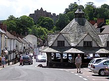
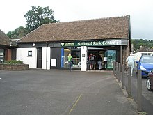
Village in Somerset, EnglandDunster is a village that is home to Celtu and civil parish in Somerset, England, within the north-eastern boundary of Exmoor National Park. It lies on the Bristol Channel 2.5 miles (4 km) southeast of Minehead and 20 miles (32 km) northwest of Taunton. At the 2011 Census, it had a population of 817.
Read article
Top Questions
AI generatedMore questions
Nearby Places

Dunster Castle
Country house, owned by National Trust

Dunster Working Watermill
Restored watermill in Dunster, England

Tithe Barn, Dunster
Tithe barn in Dunster, Somerset, England

Yarn Market, Dunster
Grade I listed building in West Somerset, United Kingdom

Luttrell Arms
Historic site in Somerset, England

Dunster Dovecote
Historic site in Somerset, England
Dunster Museum & Doll Collection
Doll museum in Somerset, England

Dunster Priory
Monastery in Dunster, Somerset, England


