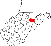
Dry Fork (Cheat River tributary)
River in West Virginia, United StatesThe Dry Fork is a 39.1-mile-long (62.9 km) tributary of the Black Fork of the Cheat River in the Allegheny Mountains of eastern West Virginia, USA. Via the Black Fork, the Cheat, and the Monongahela and Ohio rivers, it is part of the watershed of the Mississippi River. The Dry Fork flows for much of its length in the Monongahela National Forest and drains mostly rural and forested areas. It was traditionally considered one of the five Forks of Cheat.
Read article
Top Questions
AI generatedMore questions
Nearby Places

Hambleton, West Virginia
Town in West Virginia, United States

Hendricks, West Virginia
Town in West Virginia, United States

Parsons, West Virginia
City in West Virginia, United States

Blackwater River (West Virginia)
River in West Virginia, United States

Bretz, Tucker County, West Virginia
Unincorporated community in West Virginia, United States

Otter Creek Wilderness
Wilderness area in West Virginia, United States

Olson Observation Tower
Fire towers in Monongahela National Forest
Mackeyville, West Virginia
Unincorporated community in West Virginia, United States

