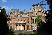
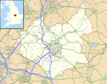
Drayton, Leicestershire
Human settlement in EnglandDrayton is a small village and civil parish in the Harborough district of south-east Leicestershire, bordering Northamptonshire and Rutland. It is situated 6.7 miles (11 km) northeast of Market Harborough and 5 miles (7.5 km) southwest of Uppingham on the north side of the Welland valley. Nearby villages are Bringhurst, Great Easton and Nevill Holt. The church of St James in Drayton is one of the smallest churches in England.
Read article
Top Questions
AI generatedMore questions
Nearby Places
Cottingham, Northamptonshire
Village in Northamptonshire, England

Bringhurst
Human settlement in England

Great Easton, Leicestershire
Human settlement in England

Medbourne
Middleton, Northamptonshire
Human settlement in England

East Carlton
Village in Northamptonshire, England

Medbourne railway station
Former railway station in Leicestershire, England

St Nicholas' Church, Bringhurst
Church in Bringhurst, Leicestershire


