Dinkelberg
Hill range in GermanyThe Dinkelberg is a partially forested hill range, up to 536.2 m above sea level (NHN), about 145 km2 in area, in the High Rhine region of Germany. It lies within the counties of Lörrach and Waldshut in the German state of Baden-Württemberg and the Swiss canton of Basel-Stadt. It is on the southwestern edge of the Southern Black Forest, from which it is geologically distinct.
Read article


Top Questions
AI generatedMore questions
Nearby Places

Schopfheim
Town in Baden-Württemberg, Germany

Maulburg
Municipality in Baden-Württemberg, Germany
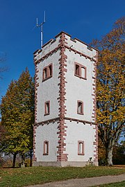
Hohe Flum
Plattensandstein
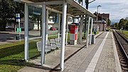
Maulburg station
Railway station in Maulburg, Germany
Schopfheim West station
Railway station in Schopfheim, Germany

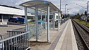
Schopfheim station
Railway station in Schopfheim, Germany
Schopfheim-Schlattholz station
Railway station in Germany