Denmark Street
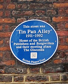
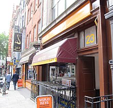
Street in LondonDenmark Street is a street on the edge of London's West End running from Charing Cross Road to St Giles High Street. It is near St Giles in the Fields Church and Tottenham Court Road station. The street was developed in the late 17th century and named after Prince George of Denmark. Since the 1950s it has been associated with British popular music, first via publishers and later by recording studios and music shops. A blue plaque was unveiled in 2014 commemorating the street's importance to the music industry.
Read article
Top Questions
AI generatedMore questions
Nearby Places

Centre Point
Building in Central London, England

Foyles
English bookstore chain

St Giles in the Fields
London church
Helter Skelter Publishing

Gioconda coffee bar
Restaurant in London, England

Denmark Place fire
Fatal fire in London in 1980

Foyles Building
Former building in London, England

Bookmarks (bookshop)
Socialist bookshop in London, England


