Coln St. Dennis
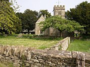
Human settlement in EnglandColn St. Dennis is a village and civil parish on the River Coln in Gloucestershire about 3 miles (4.8 km) southwest of Northleach and about 7 miles (11 km) northeast of Cirencester. The parish includes the village of Coln Rogers and the hamlets of Calcot, Fossebridge and Winson. The Fosse Way Roman road, which is now the A429 trunk road, forms the western boundary of the parish.
Read article
.jpg)

Top Questions
AI generatedMore questions
Nearby Places

Coln Rogers
Human settlement in England

Calcot, Gloucestershire
Human settlement in England
Yanworth
Human settlement in England

RAF Bibury
Winson, Gloucestershire
English village

Church of St Andrew, Coln Rogers
Church

Church of St James, Coln St. Dennis
Church

Church of St Leonard, Stowell Park
Church