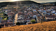
Clunia
Clunia was an ancient Roman city. Its remains are located on Alto de Castro, at more than 1000 metres above sea level, between the villages of Peñalba de Castro and Coruña del Conde, 2 km away from the latter, in the province of Burgos in Spain. It was one of the most important Roman cities of the northern half of Hispania and, from the 1st century BC, served as the capital of a conventus iuridici in the province Hispania Tarraconensis, called Conventus Cluniensis. It was located on the road that led from Caesaraugusta (Zaragoza) to Asturica Augusta (Astorga). The city declined during the 3rd century and was largely abandoned by the Visigothic era. Clunia is a toponym of Arevacian origin.
Read article
Top Questions
AI generatedMore questions
Nearby Places
Arauzo de Salce
Municipality and town in Castile and León, Spain

Arauzo de Torre
Municipality and town in Castile and León, Spain
Arandilla
Municipality and town in Castile and León, Spain

Arauzo de Miel
Municipality and town in Castile and León, Spain

Brazacorta
Municipality and town in Castile and León, Spain

Huerta de Rey
Municipality and town in Castile and León, Spain
Quintanarraya
Town in Castile and León, Spain

Theatre of Clunia Sulpicia
Roman theatre in the ancient city of Colonia Clunia Sulpicia in Spain


