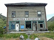
Chitina River
River in Alaska, United StatesThe Chitina River is a 274 km (170 mi) tributary of the Copper River in the U.S. state of Alaska. It begins in the Saint Elias Mountains at the base of Chitina Glacier and flows generally northwest through the Wrangell–St. Elias National Park and Preserve to meet the smaller river near Chitina. The watershed was once a major copper mining region.
Read article
Top Questions
AI generatedMore questions


