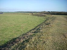
Chiselbury
Iron Age hillfort in Wiltshire, EnglandChiselbury is the site of an Iron Age univallate hillfort in Wiltshire, England. The hillfort is sub-circular in plan, and encloses an area of approximately 10.5 acres (460,000 sq ft). It is defined by an earthen rampart up to 3.6 metres (12 ft) in height and an external ditch, up to a maximum of 1.6 metres (5.2 ft) in depth. A gap in the south-eastern side of the rampart, and a corresponding causeway across the ditch, is thought to be the original entrance and is associated with a small D-shaped embanked enclosure, which is apparently visible on aerial photographs. Although the enclosure has subsequently been degraded by ploughing, it is still apparent as a series of low earthworks.
Read article
Top Questions
AI generatedMore questions
Nearby Places
Gurston Down Motorsport Hillclimb

Fovant
Village in Wiltshire, England

Compton Chamberlayne
Village in Wiltshire, England
Dinton Quarry
Geological Site of Special Scientific Interest in Wiltshire, England
Dinton Railway Cutting

Knapp and Barnett's Downs

Fovant Badges
World War I memorial in Fovant, Wiltshire, England, UK

Compton Park House
Manor house in Wiltshire, England


