Chelsea Harbour
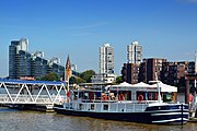
Mixed-use development in London, EnglandChelsea Harbour is a prestigious mixed-use development in West London, situated in its Sands End area, along Chelsea Creek, the historic southeastern boundary of the London Borough of Hammersmith and Fulham with the southwestern boundary of the Royal Borough of Kensington and Chelsea, and opposite the site of the old Lots Road Power Station in Chelsea. The development consists of luxury apartments, the Chelsea Harbour Marina and the Chelsea Harbour Design Centre and a hotel, 'the Chelsea Harbour Hotel'.
Read article


.jpg)


.jpg)
Top Questions
AI generatedMore questions
Nearby Places
Sands End
Human settlement in England

Lots Road Power Station
Disused power station in Chelsea, London

Counter's Creek
Culverted stream in west London

Imperial Wharf railway station
London Overground station

Battersea Railway Bridge
Bridge across the River Thames in London

Kensington Canal
United Kingdom legislation
Chelsea Harbour Pier
Pier on the River Thames in London, United Kingdom

Chelsea Academy
Academy in Chelsea, London, England