Caer Euni
Caer Euni [Grid reference SJ 00027 41266] is an Iron Age hillfort, about 2.5 miles (4 km) north-east of the village of Llandderfel and about 5 miles (8 km) north-east of Bala Lake, in Gwynedd, Wales. It is a scheduled monument.
Read article


Top Questions
AI generatedMore questions
Nearby Places

A494 road
Road in Great Britain
Llandrillo railway station
Former railway station in Denbighshire, Wales

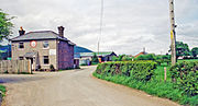
Cefnddwysarn
Human settlement in Wales

Glan-yr-afon, Gwynedd
Human settlement in Wales

Llangwm, Conwy
Human settlement in Wales

Llandderfel
Human settlement in Wales

Druid, Denbighshire
Village in Denbighshire, Wales

St Derfel's Church, Llandderfel
Church in Gwynedd, Wales