Buerton, Cheshire East
Human settlement in EnglandBuerton is a village at SJ685435 and civil parish in the unitary authority of Cheshire East and the ceremonial county of Cheshire, England, about 7 miles south of the town of Nantwich and 1½ miles east of the village of Audlem, on the border with Shropshire. The parish also includes the small settlements of Hankins Heys, Moblake, Pinder's End and Three Wells, as well as parts of Chapel End, College Fields, Kinsey Heath, Longhill, Raven's Bank, Sandyford and Woolfall. In 2001, the total population was a little under 500, which had increased marginally to 503 at the 2011 Census. Nearby villages include Adderley, Audlem, Bridgemere, Hankelow, Hatherton, Hunsterson and Woore.
Read article


.jpg)
Top Questions
AI generatedMore questions
Nearby Places

Audlem
Village in Cheshire, England

St James' Church, Audlem
Church in Cheshire, England

Highfields, Buerton
Historic site in Cheshire, England

Hankelow
Human settlement in England

Little Heath, Cheshire East
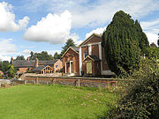
Audlem Baptist Church
Church in Cheshire, England
Moblake
Human settlement in England

Ball Farm