Map Graph

Brewood

Town and civil parish in Staffordshire, England

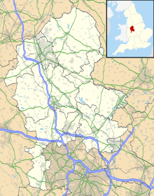
Brewood is an ancient market town in the civil parish of Brewood and Coven, in the South Staffordshire district, in the county of Staffordshire, England. Brewood lies near the River Penk, 8 miles (13 km) north of Wolverhampton and 11 miles (18 km) south of Stafford. Brewood is about 3 miles (4.8 km) east of the county border with Shropshire.

Read article
File:Farmland_south_of_Brewood_in_Staffordshire_-_geograph.org.uk_-_5833939.jpgFile:Market_Place,_Brewood_-_geograph.org.uk_-_6209771.jpgFile:Brewood_-_Speedwell_Castle_-_geograph.org.uk_-_5233240.jpgFile:Brewood_-_St_Mary_^_St_Chad_Church_-_geograph.org.uk_-_5233232.jpgFile:Brewood_and_Coven_-_Roman_Catholic_Church_of_St_Mary_-_20230826095407.jpegFile:Staffordshire_UK_location_map.svgFile:Brewood.jpgFile:Brewood_CE_Church.jpgFile:Brewood_church.pngFile:White_Ladies_Priory.jpgFile:The_Leper_Well,_Gunstone,_Staffordshire.jpgFile:Brewood_Grammar_School_1799_7475-0.jpgFile:Brewood_Grammar_School.jpgFile:Brewood_Market_Place_01.JPGFile:Speedwell_Castle,_Brewood_-_geograph.org.uk_-_1805217.jpgFile:Giffards_Cross_and_Lodge.JPGFile:Chillington_Hall_Upper_Avenue_01.JPGFile:Sir_John_Giffard-Elizabeth-Jane-Brewood_1556.JPGFile:Sir_Thomas_Giffard-Dorothy-Ursula-Brewood_1560.JPGFile:John_Giffard.JPGFile:Walter_Giffard_of_Brewood.JPGFile:Moreton_Family_Memorial_Brewood.JPGFile:William_and_Mary_arms_Brewood.JPGFile:Brewood_Pop.svgFile:Brewood_canal_south.JPGFile:Thomas_Telford_aqueduct_over_A5.jpgFile:Brewood_canal_north.JPGFile:Brewood_Fire_Station.jpgFile:Brewood_RC_Church.jpgFile:Bishops_Wood_church_01.JPGFile:Coven_-_St_Pauls_church_exterior_01.jpgFile:Coven_-_Methodist_church_01.jpgFile:Brewood_Wesleyan_chapel.JPG
Top Questions
AI generated

List the top facts about Brewood

Summarize this article

What is the single most intriguing fact about Brewood?

Are there any controversies surrounding Brewood?

More questions