Brandon, Suffolk
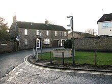
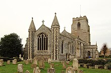
Town in Suffolk, EnglandBrandon is a town and civil parish in the English county of Suffolk. Brandon is located in the Breckland area of Suffolk in the extreme north-west of the county, close to the adjoining county of Norfolk. It lies between the towns of Bury St Edmunds, Thetford, Mildenhall, Downham Market and the city of Ely. The town is almost entirely surrounded by Thetford Forest.
Read article
Top Questions
AI generatedMore questions
Nearby Places

Thetford Forest
Forest in the United Kingdom

Brandon railway station
Railway station in Norfolk, England, United Kingdom

Weeting Castle
Ruined, medieval manor house in England

Weeting
Village in England

Santon Downham
Village in Suffolk, England

Weeting Heath
Nature reserve in Norfolk, England

London Road Industrial Estate, Brandon

Brandon Country Park


