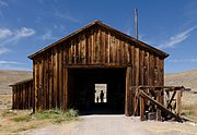
Bodie Hills
The Bodie Hills is a low mountain range in Mono County, California, in the United States. The highest peak is Potato Peak at an altitude of 10,220 ft (3,115 m). The Bodie Hills are between Bridgeport and the Nevada border, where they become the Bodie Mountains in Mineral County, Nevada. The Sierra Nevada lies to the west. The mining district and town of Bodie, California, is located in the Bodie Hills.
Read article
Top Questions
AI generatedMore questions


