Bitterroot River
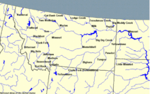
River in Montana, United StatesThe Bitterroot River is a northward flowing 84-mile (135 km) river running through the Bitterroot Valley, from the confluence of its West and East forks near Conner in southern Ravalli County to its confluence with the Clark Fork River near Missoula in Missoula County, in western Montana. The Clark Fork River is a tributary to the Columbia River and ultimately, the Pacific Ocean. The Bitterroot River is a Blue Ribbon trout fishery with a healthy population of native westslope cutthroat trout and bull trout. It is the third most fly fished river in Montana behind the Madison and Big Horn Rivers.
Read article
Top Questions
AI generatedMore questions
Nearby Places

Orchard Homes, Montana
Census-designated place in Montana, United States
Lindborg-Cregg Field

Fort Missoula Internment Camp

Fort Missoula
United States historic place
KGVO (AM)
Radio station in Montana, United States
Hell Gate, Montana
Ghost town in the state of Montana
Community Medical Center (Montana)
Hospital in Montana, United States
Big Sky High School
Public school in Missoula, Montana, United States


