Binnendieze
River in NetherlandsBinnendieze is the common name for the river and canal system within the city walls of 's-Hertogenbosch, the Netherlands. It is a tourist attraction. Near the north-west tip of the city walls, the confluence of the Binnendieze with the rivers Aa and Dommel forms the short river Dieze, tributary of the Meuse.
Read article


Top Questions
AI generatedMore questions
Nearby Places

Dommel
River in Belgium, Netherlands

Aa (Meuse)
River in Netherlands

Roman Catholic Diocese of 's-Hertogenbosch
Latin Catholic territory in the Netherlands
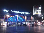
's-Hertogenbosch railway station
Railway station located in 's-Hertogenbosch, the Netherlands

't Misverstant
Restaurant in Den Bosch, Netherlands

W2 Poppodium
Building in 's-Hertogenbosch, Netherlands

Brabanthallen
Convention center in The Netherlands

Citadel of 's-Hertogenbosch
Fortress in the Netherlands