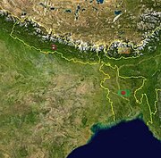
Map Graph

Bihar

State in Eastern India

Bihar is a state in Eastern India. It is the third largest state by population, the 12th largest by area, and the 15th largest by GDP in 2021. Bihar borders Uttar Pradesh to its west, Nepal to the north, the northern part of West Bengal to the east, and Jharkhand to the south. Bihar is split by the river Ganges, which flows from west to east. On 15 November 2000, southern Bihar was ceded to form the new state of Jharkhand. Only 11.27% of the population of Bihar lives in urban areas as per a 2020 report. Additionally, almost 58% of Biharis are below the age of 25, giving Bihar the highest proportion of young people of any Indian state. The official language is Hindi, which shares official status alongside that of Urdu. The main native languages are Maithili, Magahi and Bhojpuri. But there are several other languages being spoken at smaller levels.

Read article
File:Temple_No.-_3,_Nalanda_Archaeological_Site.jpgFile:Mahabodhi_Temple_-_Bodh_Gaya.jpgFile:Buddha_Smriti_Park.jpgFile:Fort_of_Darbhanga.jpgFile:Golghar_patna.jpgFile:Seal_of_Bihar.svgFile:IN-BR.svgFile:SH_IN-BR.pngFile:Kundpur_seal.jpgFile:Mahajanapadas_(c._500_BCE).pngFile:Chandragupt_maurya_Birla_mandir_6_dec_2009_(31)_(cropped).JPGFile:Dr_Rajendra_Pd._DR.Anugrah_Narayan_Sinha.jpgFile:Valmikinagar_Hydel_Project,_Bihar.jpgFile:Flooded_Bihar.JPGFile:Mountain_of_Ashram.jpgFile:Bengal_Tiger7.jpgFile:Bauhinia_Acuminata.jpgFile:Kanwar_Lake_Begusarai_by_Ziddi_Photowala.jpgFile:Patna_high_court1.jpgFile:Vidhan-sabha-bihar.jpgFile:Secretariat_Building_patna.JPGFile:Patna_division.svgFile:Magadh_division.svgFile:Tirhut_division.svgFile:Saran_division.svgFile:Darbhanga_division.svgFile:Kosi_division.svgFile:Purnia_division.svgFile:Bhagalpur_division.svgFile:Munger_division.svgFile:View_of_Patna_city_from_the_top_of_Golghar.jpgFile:Vishnupadh_Temple.jpgFile:Ghantaghar_Bhagalpur.jpgFile:Station_Chowk_of_Bettiah_City.jpgFile:MUZAFFARPUR_CITY_LATEST.jpgFile:Bapudham_Motihari_Station_Board.jpgFile:Purnea_Skyline.jpgFile:Matasyagandha_Madndir_Saharsa.jpgFile:Fort_of_munger-Munger-Bihar.jpgFile:Arrah_Chhapra_June_2017.jpgFile:Sher_shah_suri_tomb_sasaram.jpgFile:Janakisthan,_Sitamarhi,_Bihar.jpgFile:Ara_Junction.jpgFile:Ruins_of_Rajnagar_Madhubani_district.jpgFile:Samastipur_Junction_(junction_plate).jpgFile:The_Chief_Minister_of_Bihar,_Shri_Nitish_Kumar_discussing_with_the_Prime_Minister,_Dr._Manmohan_Singh_about_the_relief_operations_on_flood-affected_areas,_in_Bihar,_August_28,_2008.jpgFile:Nitish_Kumar,_Samrat_Chaudhary,_J.P_Nadda,_Mangal_Pandey_and_other_leaders_of_NDA_inaugurating_health_projects_worth_₹850_crore.jpgFile:The_eye_hospital_established_in_Nitish_Kumar's_tenure_with_investment_of_₹_188_crore.jpgFile:Vikramshila_Agrovet_2_Langra_Mango_farm,_Mathurapur,_Bhagalpur_Bihar.JPGFile:Lychee.jpgFile:Foxnut_Makhana_-_Nawada_District_-_Bihar_-_1.jpgFile:Nitish_Kumar_inspecting_a_leather_park_at_Bela.jpgFile:Nitish_Kumar_inaugurated_Ambuja_cement_Ltd_cement_grinding_facility_in_Warsaliganj.jpgFile:Madhubani_Mahavidyas.jpgFile:Snake_Charmer,_India,_Patna_School,_19th_century,_Honolulu_Museum_of_Art.JPGFile:Sharmila_Sharma_et_Rajendra_Kumar_Gangani_2.jpgFile:Mahabodhitemple.jpgFile:Nalanda_Mounds.jpgFile:Gangetic_Dolphin.jpgFile:Bihar_Museum_Children_and_Wildlife_Section.jpgFile:"_Tomb_of_Sher_Shah_Suri_".jpgFile:Ghora_katora_lake.jpgFile:Isbt_patna.jpgFile:Patna_river_port1.JPGFile:Nitish_Kumar_and_Tejaswi_Yadav_inaugurating_the_work_of_Patna_Metro.jpgFile:Front_view_of_administrative_building_of_IIT_Patna.jpgFile:NITPMainBuilding.jpg
Top Questions
AI generated

List the top facts about Bihar

Summarize this article

What is the single most intriguing fact about Bihar?

Are there any controversies surrounding Bihar?

More questions
Timeline
AI Generated
  • 2500–1345 BCEPeriod of early settlements in Bihar.
  • 1100–500 BCEVideha becomes one of the major political and cultural centers of South Asia.
  • 1198Bakhtiyar Khalji commits a massacre in a town identified with Bihar Sharif.
Show full timeline