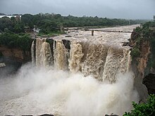
Belagavi district
District of Karnataka in IndiaBelagavi district, formerly also known as Belgaum district, is a district in the state of Karnataka, India. The district is known as the sugar bowl of Karnataka with 150,000 hectares being used for commercial production. It has overtaken Mandya district in sugarcane production over the last decade. The city of Belgaum (Belagavi) is the district headquarters in Belagavi district. It houses the Second legislative building, where the Karnataka Legislature holds session once a year. The district is famous for its native sweet, Kunda. According to the 2011 Census of India, it has a population of 4,779,661, of which 24.03% live in urban areas, making it the second most populous district in Karnataka, after Bangalore Urban. The district has an area of 13,415 km2 (5,180 sq mi), making it the largest district in terms of size in Karnataka It is bounded by Kolhapur District and Sangli district of Maharashtra state on the west and north, on the northeast by Bijapur district, on the east by Bagalkot district, on the southeast by Gadag district, on the south by Dharwad and Uttara Kannada districts, and on the southwest by the state of Goa.


